
|
|


 SITUATION
Click to See Map >>>
SITUATION
Click to See Map >>>
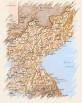
Korea is situtated in the central part in the East of Asia, between the 43º00'36'' (Fungso, Onsong district, North Jamkiong Province), the 33º06'32'' (Mara island, Namzezu district, Zezu province) of northern latitude and the 124º10'47'' (Bidan island, Riongchon district, North Piong-an province) and 131º52'40'' (Dok island, Ulung district, North Kiongsang province) of eastern latitude.
In Korea is used the time from meridian 135º.
The land is formed by the Korean peninsula and the 4.198 islands surrounding it.
The total surface of Korea is 222.209,231 square kilometers, where 5.974,655 (2,69%) belong to the islands.
The maximum lenght from North to South is around 1.127,16 kilometers and the maximum width from East to West is 645,25 kilometers (including the islands in both cases).
Korea has borders in the North with the People's Republic of China and the Russian Federation through the rivers Amrok and Duman, and at the East, West and South is surrounded by sea.
The terrestrial border has 1.369,37 kilometers, and the lenght of the sea-coast is around 18.019,74 kilometers (including the islands) or 7.809,27 kilometers (only in the peninsula).
Next Page

